

2022 Ecological Assessment of the Illinois River Watershed
Monitoring ecological health and watershed conditions to improve management decisions.
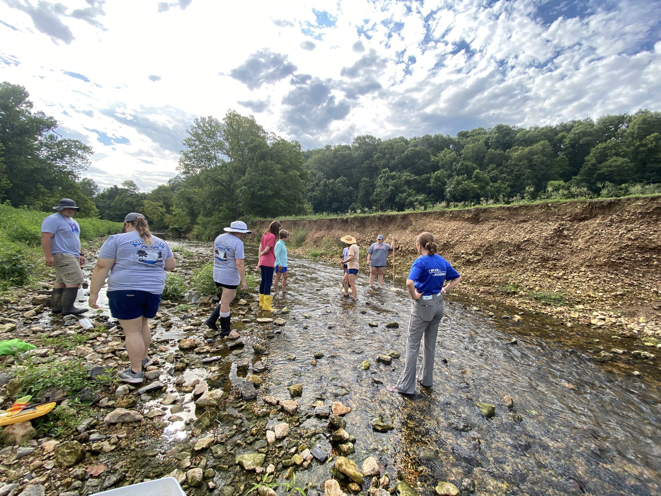
Macroinvertebrates are a biological indicator of watershed health.
Macroinvertebrates represent an important indicator of the biological health of the Illinois River and its subwatersheds. Species such as Mayflies, Stoneflies, Midges and Crayfish are reliable indicators of water quality throughout the watershed because they spend all or most of their lives in water, are easy to collect and differ in their tolerance to pollution. These and 18 other macroinvertebrates we looked for usually respond to human disturbance in predictable ways, are easy to identify, and are relatively easy to collect.

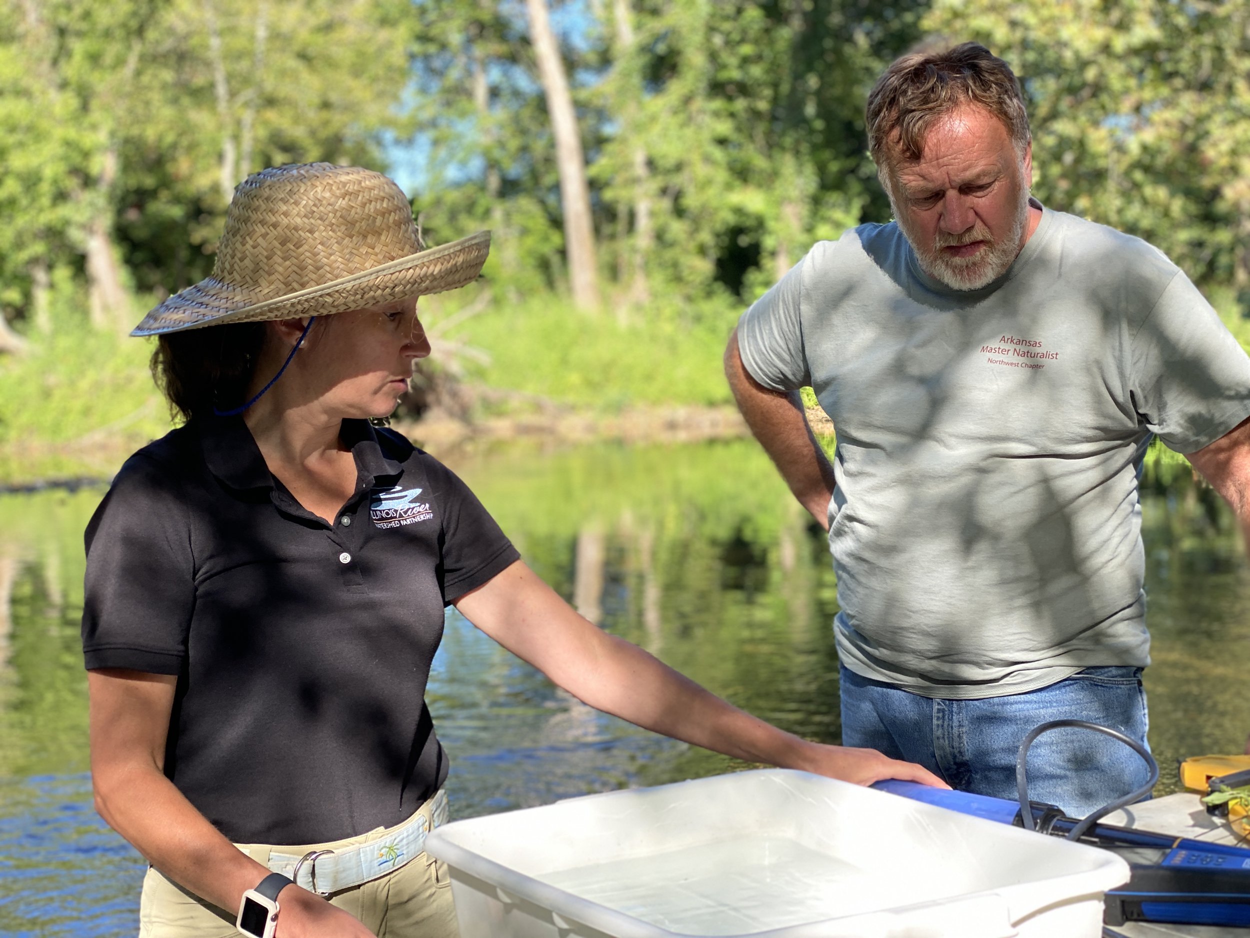
How do we study ecological health?
In 2018, 2019, and 2022, IRWP partnered with local schools’ Environmental and Spatial Technology (EAST) programs to assess twenty-one locations in April, August, and November of each year. In 2020 and 2021, IRWP partnered with Oklahoma Conservation Commission’s Blue Thumb staff and volunteers to assess twelve locations during the same months. Arkansas subwatersheds were the focus of the 2022 EcoAssessment report. The full report summarizes findings from the first five years of study while we focus here on the Arkansas portion of the watershed which makes up approximately 46% of the entire Illinois River Watershed.
We conducted stream habitat assessments, macroinvertebrate sampling, land use change analysis, and conducted statistics analysis using accepted methods such as EPA’s Volunteer Stream Monitoring: A Methods Manual, the Arkansas Game and Fish Commission’s Stream Team method for macroinvertebrate scoring, and Izaak Walton League of America – Stream Insects and Crustaceans for macroinvertebrate identification.


Macroinvertebrate Diversity Results in Oklahoma and Arkansas
Macroinvertebrate diversity was significantly higher across all Oklahoma sites when compared to Arkansas. In Arkansas, the sites with the lowest diversity scores were found in Moore’s Creek and Sager Creek subwatersheds. The site with the highest diversity score in Arkansas was found in Clear Creek subwatershed. In Oklahoma, the site with the lowest average diversity score was found in Barren Fork and the site with the highest average diversity score was found in Flint Creek (see figure).

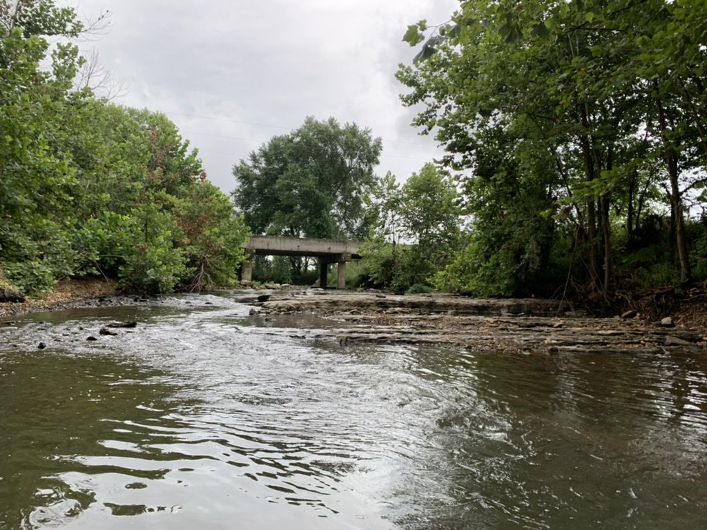
Clear Creek
Clear creek is the most urbanized subwatershed assessed in this project. The area continues to urbanize throughout all major tributaries. The assessed tributaries of Clear Creek include sites upstream and downstream of Lake Fayetteville – a reservoir created in 1949 as a drinking water supply for the City of Fayetteville. Today, the lake features extensive recreational amenities that are owned and managed by the city.
Urban development in the Clear Creek subwatershed has increased by 26% from 1992 to 2019 (up 3% from 2016). Areas upstream of Lake Fayetteville are particularly vulnerable as farmland and remnant prairies are converted to medium to low density urban development.
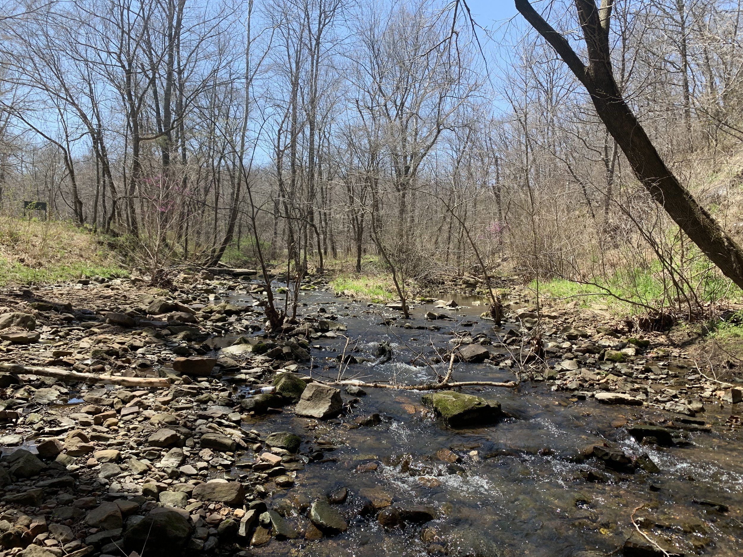
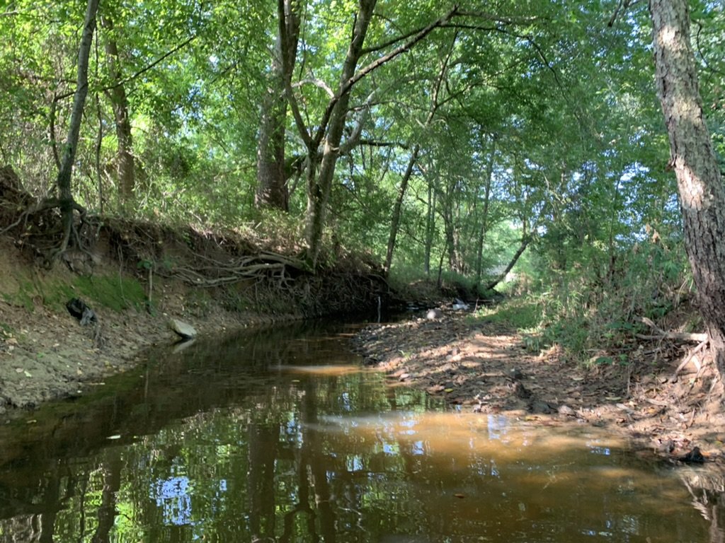
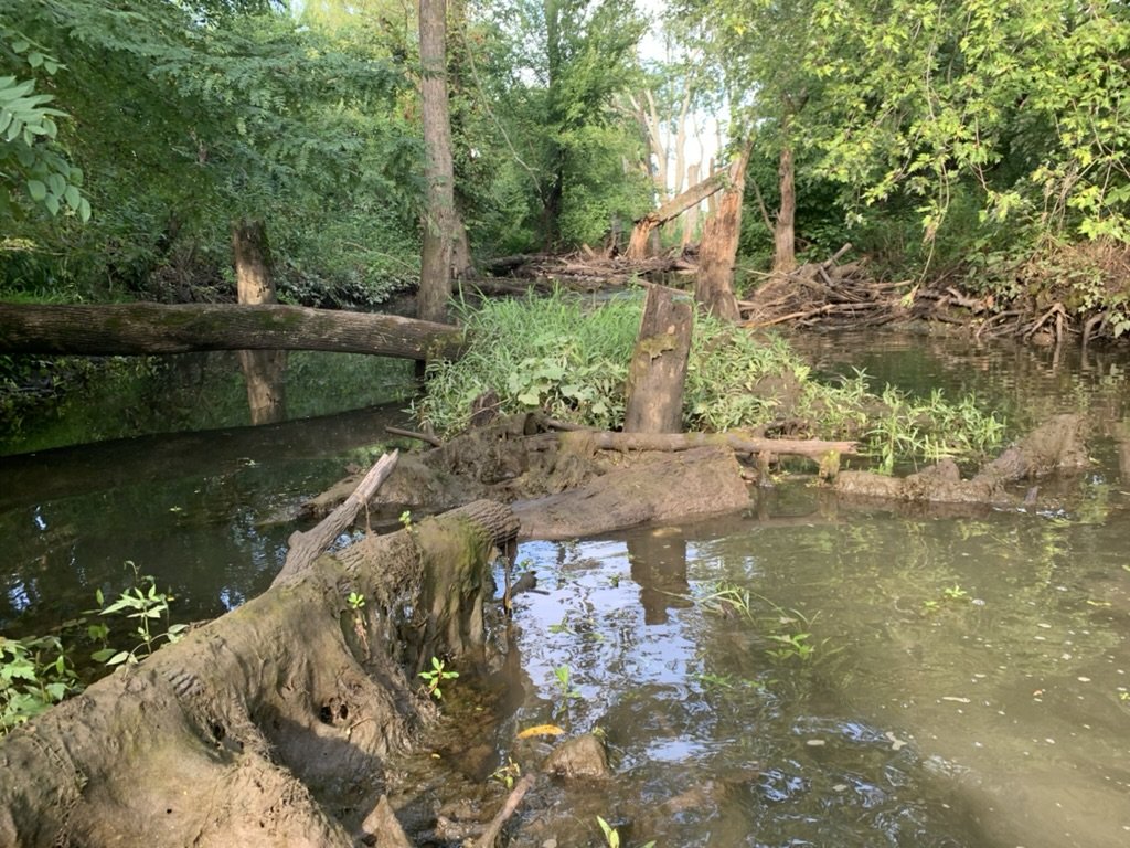
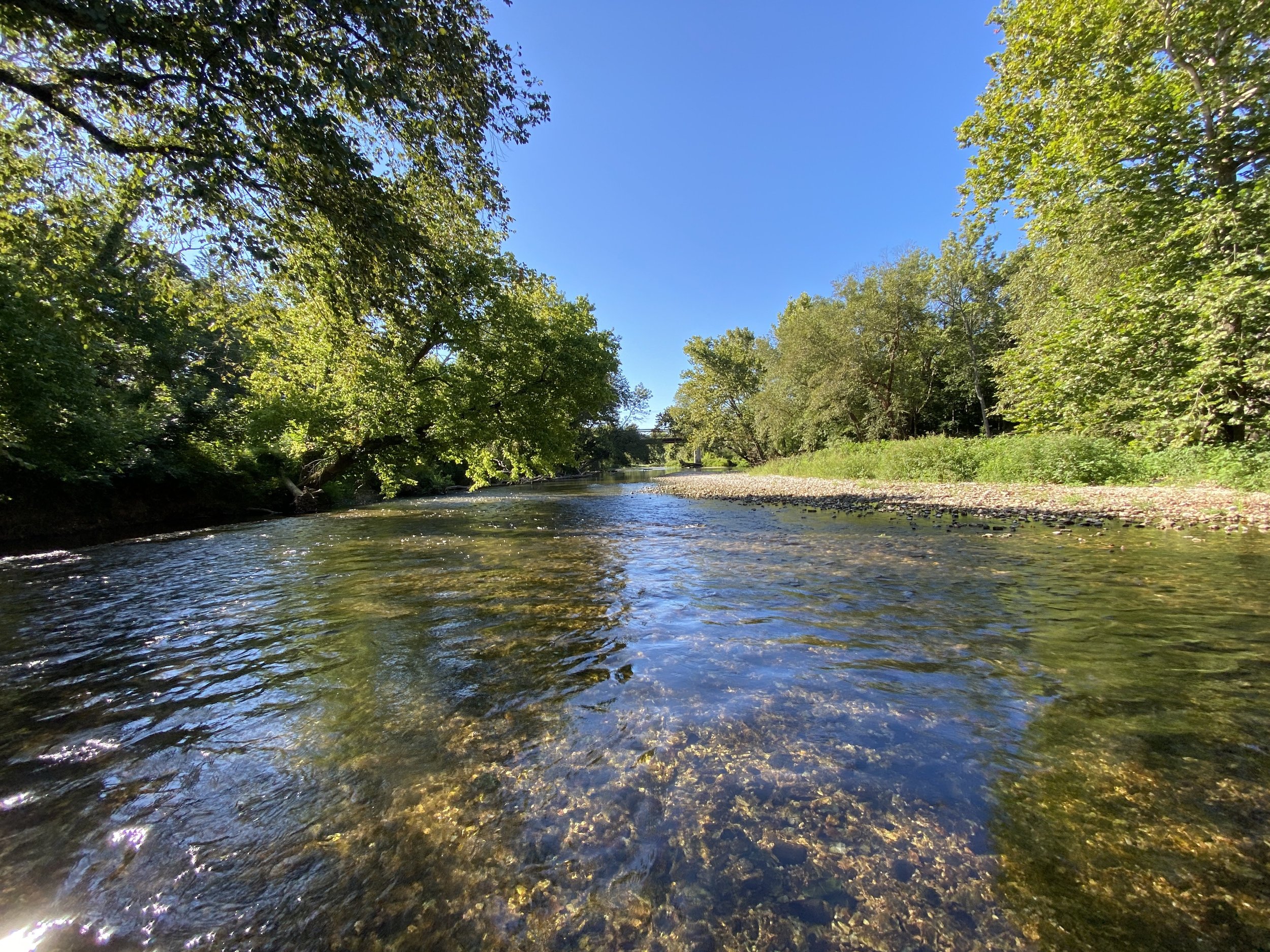
Below are images from Clear Creek’s highest (left) and lowest (right) diversity scores from 2022. Clear Creek 3 (left) shows an abundant amount of gravel and cobbles that serve as habitat for macroinvertebrates. Clear Creek 1 (right) shows heavily eroded streambanks with little riparian buffer. This site contained the highest phosphorus and sulfate concentration in the Clear Creek Subwatershed.


Data suggests that Clear Creek has maintained relatively stable diversity from 2018 to 2022 and the highest average macroinvertebrate diversity score (17) in Arkansas from 2018-2022. Clear Creek 5 has the highest average macroinvertebrate diversity (25). The streambottom composition for Clear Creek found very little silt/clay/mud and a diverse mixture of gravel, cobbles, and boulders - ideal for macroinvertebrate habitat.
Management recommendations for Clear Creek include: Permanent or semi-permanent conservation of undeveloped areas around waterways. Low Impact Development practices for all parcels with residential or commercial development. Restoration of all incised stream reaches using natural channel design, followed by permanent conservation of surrounding land. Continued water quality monitoring including parameters such as nutrients, total dissolved solids, and bacteria.

Moore’s Creek
Moore’s Creek is a rural subwatershed located in southern Washington County, Arkansas. The city of Lincoln (pop. 2,444) is located in the watershed and includes Lincoln Lake – a 90-acre reservoir originally used as the city’s water supply. The lake offers recreation opportunities including mountain biking, hiking, rock climbing, non-motorized boating, and fishing. Agricultural land is the predominant land use, but large areas of forest exist at upper elevations on the norther boundary of the Boston Mountains.
Developed land has increased 7% from 1992 to 2019 in the Clear Creek Subwatershed. This increase is likely due to the conversion of land designated as row crops, grass/shrub land, and barren land.
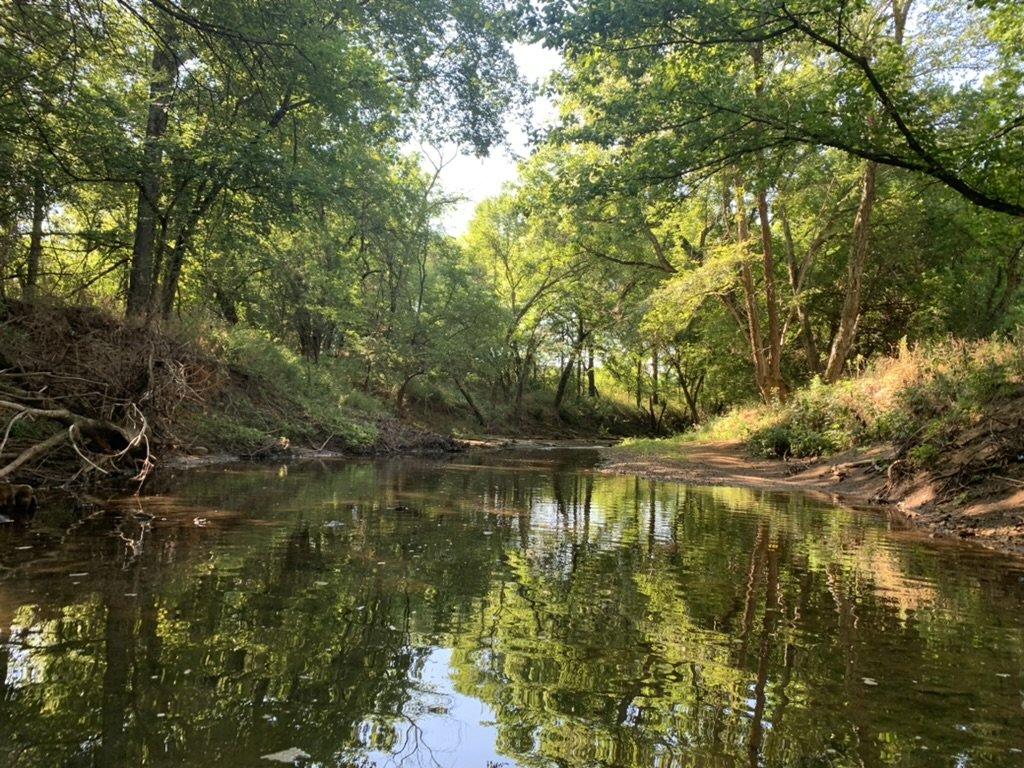
Below, the site of the left, MC 3, is a good example of the diversity of stream habitat that is needed to support diverse macroinvertebrate communities. The creek is on the same elevation as the surrounding land use, indicating no incision or erosion is occurring. And there is a wide variety of rock sizes, surface types, and flow regimes that macroinvertebrates can utilize. The site on the right, on the other hand, is incised and eroding, contains turbid water (indicating deposition of silt and mud), and lacks variation in habitat (i.e., no riffles, runs, or pools).
Moore’s Creek has the lowest average macroinvertebrate diversity recorded in this study (15). Moore’s 2 has the lowest average diversity within this subwatershed with a high percentage of silt/clay/mud and bedrock substrate on the streambottom – unsuitable habitat for macroinvertebrates. MC 5 shows the most improvement with an increase of 79%.
Management recommendations for Moore’s Creek include re-establishment of riparian forests, wetlands, and floodplains, permanent or semi-permanent conservation of areas around headwaters and/or forested hillsides, Sustainable livestock practices such as rotational grazing and fencing cattle out of streams, and continued water quality monitoring including parameters such as nutrients, total dissolved solids, and bacteria.

Muddy Fork
Muddy Fork subwatershed is located just east of the Moore’s Creek subwatershed. The headwaters are located to the south of the City of Prairie Grove and the stream flows north until it converges with the Illinois River mainstem at Savoy. Land use is similar to Moore’s Creek with pasture lands dominating flat, low-lying areas and forested hillsides towards the south end of the watershed. This portion of the watershed is also experiencing and increase in the amount of urbanization and development.
Muddy Fork has undergone a 6% increase in development. This is likely due to the conversion of the land categorized as row crops, grass/shrub land, and barren land. Pasture/hay is the dominant land use in the subwatershed
The photos below compare sites with high (left) and low (right) macroinvertebrate diversity. MF 2 (left) shows diverse stream habitat with riffles, runs, and pools, as well as diverse streambottom substrate. MF 4 (right) shows incised, eroding streambanks with a high presence of silt/clay/mud.
Muddy Fork shows a 38% increase in diversity from 2018 to 2022. MF 1 and 4 both have an average diversity of 16 while MF 2 and 3 have an average of 21. When compared with streambottom composition, these diversity scores support the finding of high levels of silt/clay/mud and/or bedrock provide unsuitable habitat for macroinvertebrates.
Management recommendations for Muddy Fork include re-establishing riparian forests, wetlands, and floodplains. Permanent or semi-permanent conservation of areas around headwaters and/or forested hillsides. Sustainable livestock practices such as rotational grazing and fencing cattle out of streams. Continued water quality monitoring including parameters such as nutrients, total suspended solids, and bacteria.

Sager Creek
Sager Creek is technically a tributary of the Flint Creek subwatershed and is located in the Siloam Springs area of Arkansas. The historic ecology of the area has been upland prairie and oak savannah which has since been converted into pasture lands and suburban development. Siloam Springs has experienced rapid suburban growth recently and has taken steps to conserve and protect Sager Creek during this period of growth. The City of Siloam Springs owns much of the land surrounding Sager Creek and has annexed the land for paved trail use as well as an extensive riparian reforestation effort during the early 2000’s.
Developed land increased by 24% from 1992 to 2019. This is likely due to the conversion of pasture/hay land. Development in this area is expected to continue to rise along with the growth of Northwest Arkansas.
Sager – Whitlock (left) is a restored streamside that demonstrates healthy riparian vegetation that has been re-established. There is no active erosion and little silt, clay, or mud in the streambed. While not aesthetically pleasing, Sager – Anglin, a site that is a mix of wetland, stream, and stormwater detention features is located upstream of the left-hand photo site. The presence of silt, clay, and mud at this site was very high, but not unexpected given its function.
Sager Creek has an average diversity score of 16 and only saw a small increase in diversity in 2022. Sager Anglin has the least diversity (Figure 81) which is what would be expected when observing the streambottom composition at this site. Silt/clay/mud dominated the substrate at this site. This site also has a mix of stream, wetland, and stormwater retention features. Sager – Whitlock shows the greatest increase in macroinvertebrate diversity from 2019 to 2022. IRWP completed a streambank restoration project at this site during this time which may contribute to improved diversity.
Management recommendations for Sager Creek include low impact development features on all parcels with impervious surfaces. Permanent or semi-permanent land conservation on headwaters and upstream portions of the watershed. Continued stream and riparian restoration projects. Continued water quality monitoring including parameters such as nutrients, dissolved solids, and bacteria.
Our objective in performing this assessment was to provide decision makers within each subwatershed with information to make informed decisions regarding land use, urban planning, stormwater mitigation, and natural resource conservation opportunities.
-
For this five-year study, macroinvertebrate diversity was most related to components of the streambed and not necessarily related to components of the streambank or surrounding land use. Diversity was positively related to the presence of cobbles and gravel in the streambed and negatively related to the presence of silt, clay, and mud in the streambed. Assuming the presence of cobbles and gravel is the “natural” state (i.e. would be present at all sites if it were not for the presence of silt, clay, and mud), management recommendations include practices that have been shown to reduce the presence of these small, light, and highly erodible soil particles that are introduced to the stream via either over-land flow during rain events or streambank erosion. Other studies conducted by IRWP indicate that streambank erosion from both urban and rural settings is one of the largest contributors of phosphorus to the watershed.
-
Land use has not changed significantly across the entire watershed but is changing significantly in one area of the watershed. The population of Northwest Arkansas is expected to almost double over the next 20 years and most of the resulting land use change will occur in the Illinois River Watershed. It will likely occur in the form of pasture lands and farms converting to low density residential and commercial developments. Conserving and restoring high-value natural resources needs to happen now as prevention is (generally) much less expensive than remediation. Interestingly, two urban subwatersheds, Sager Creek and Town Branch, that recently embarked on urban stream restoration projects had relatively high macroinvertebrate diversity, indicating that such projects can prevent erosion and deposition of sediment, as well as restore ecological function.
-
Get the the full report for the last five years and data for Oklahoma and Arkansas by clicking on the button at the top of this page.